
All screenshots on this page are shared with employer permission and contain no individually identifiable or non-public information. Because of the proprietary nature of some OSU Real Property datasets, the apps themselves cannot be shared here publicly, so static images are provided for illustrative purposes.
As a part of the development of the OSU Real Property Map system, considerable effort has been made to not only compile useful, authoritative GIS datasets concerning OSU’s property holdings, but to make this data as broadly useful and available as possible. Web GIS platforms like ESRI’s ArcGIS Online and its accompanying Experience Builder and Instant Apps present an ideal opportunity to create “front ends” for different groups of stakeholders.
Clery Data Export Tool – OSU Police/OSU Public Safety
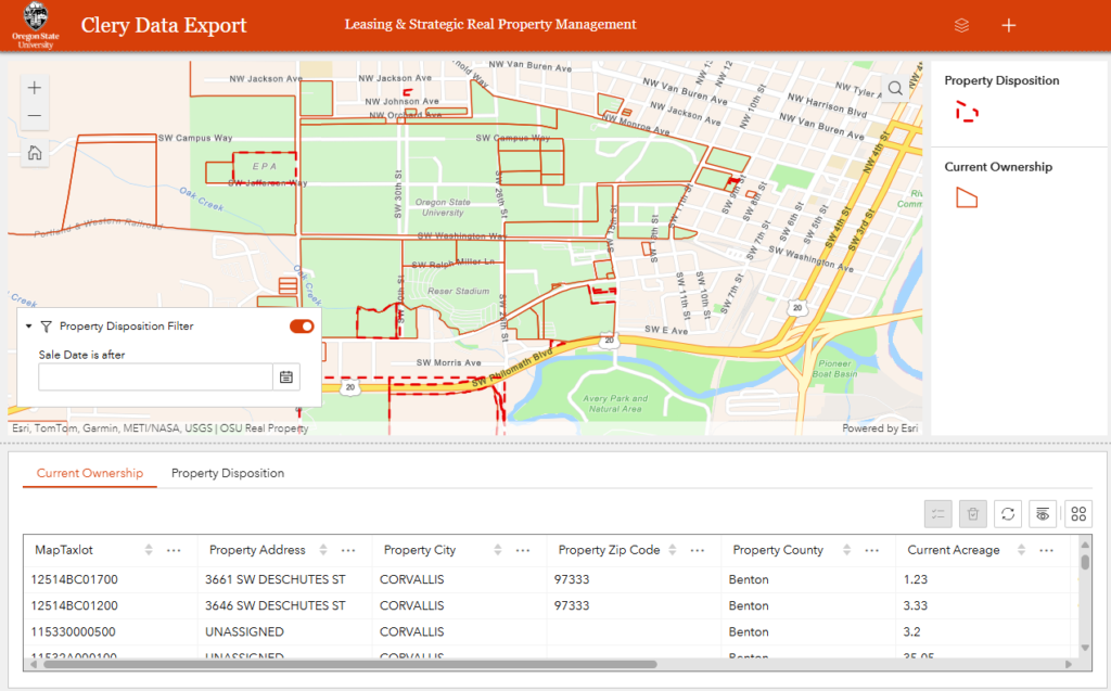
The Jeanne Clery Campus Safety Act requires all colleges and universities who receive federal financial aid to record and report information about crime on or near their campuses. OSU, as an institution that operates statewide, has broad Clery reporting responsibilities beyond just its main campus in Corvallis. Property that OSU owns is all, with few exceptions, subject to Clerty reporting requirements, so OSU’s Public Safety office must have a clear picture of where such property lies in order to collect crime information from multiple law enforcement jurisdictions and provide a complete annual Clery report each year.
As with most issues involving the question of “where,” GIS data can provide more accurate and more easily accessed information than traditional databases or spreadsheets. Previously, Public Safety utilized the OSU Property Schedule, compiled by the Insurance & Risk Management Services unit to catalog and sort properties for which crime data was needed, however this was a very manual, time intensive process, and a dataset that was compiled for insurance purposes, not an authoritative system of record of all property ownership. This very simple, internal tool allows Public Safety to query both the Current Ownership dataset and the Property Disposition dataset for any properties owned by the university but sold within the last reporting year to be sent to relevant statewide law enforcement agencies for crime data on or near these properties.
Title Work Viewer
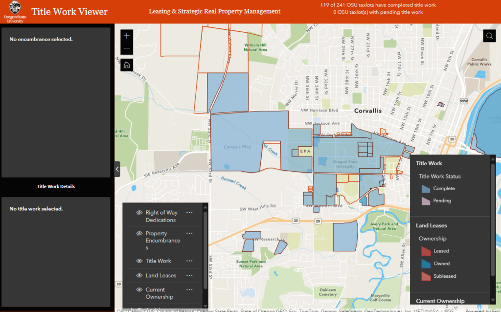
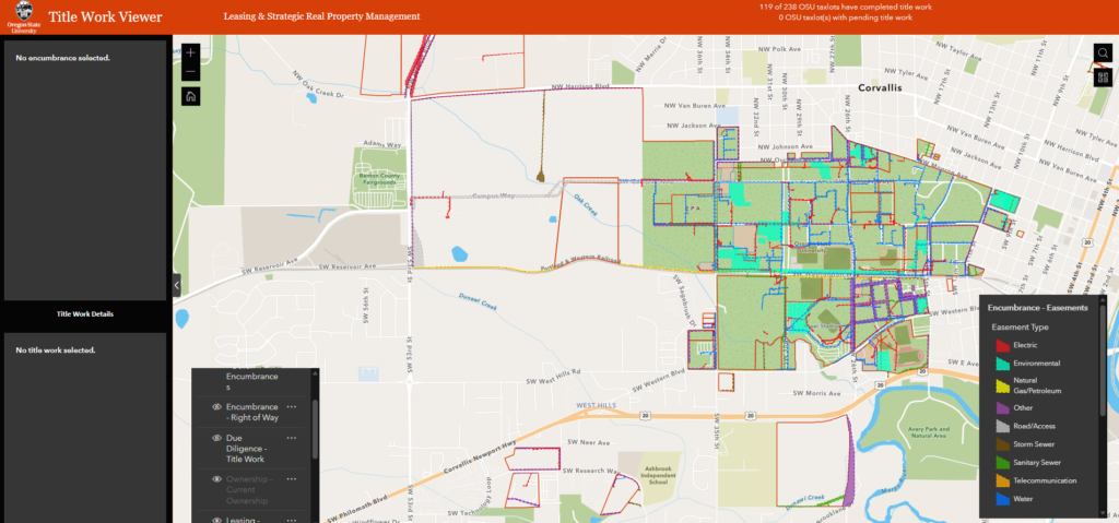
Based on greater availability and utility of encumbrance data in the Real Property Map system, OSU’s Real Property and Capital Project Delivery units instituted a new process in 2024 where, upon funding of any capital project, a title report would be procured for that property if a recent one was not already on file in order to enumerate easements and encumbrances in the area of the project in advance of work being done that might interfere with existing easements or require new easement paths.
In order to track where such recent title work exists in the Real Property unit’s database, the Title Work Viewer app was created to provide a sort of “visual checklist” of which tablets already had such work on file and which would need a new report the next time a project occurred in that location. This app also draws upon the Easements, Right-of-Way Dedication, and Other Encumbrances layer in order to better inform project managers where existing easements already exist on OSU property. While not a substitute for land surveys or locates, this resource helps give a better idea where such ground truth resources may be required and how to best direct them in order to contain costs and the time spent by our external partners.
OSU Real Property “Mapplication”
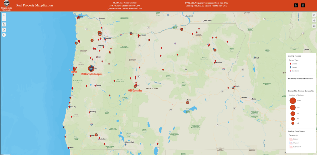
As discussed on the page outlining the impetus for the Real Property Map system, University leadership has an ongoing need for decision making tools that outline the full extent of OSU’s ownership and leasing portfolios. The “Mapplication” (first named as a placeholder, but it stuck) is an effort to provide such a simple, clear overview. A limited set of RP Map layers are used – Current Ownership, Leases (point), and Land Leases (polygon), with descriptive layers such as Campus Boundary and Site Names overlaid for context. This app provides senior leaders with a high level overview on demand using an “everything you need, nothing you don’t” design philosophy.
Ag Sites Mapper
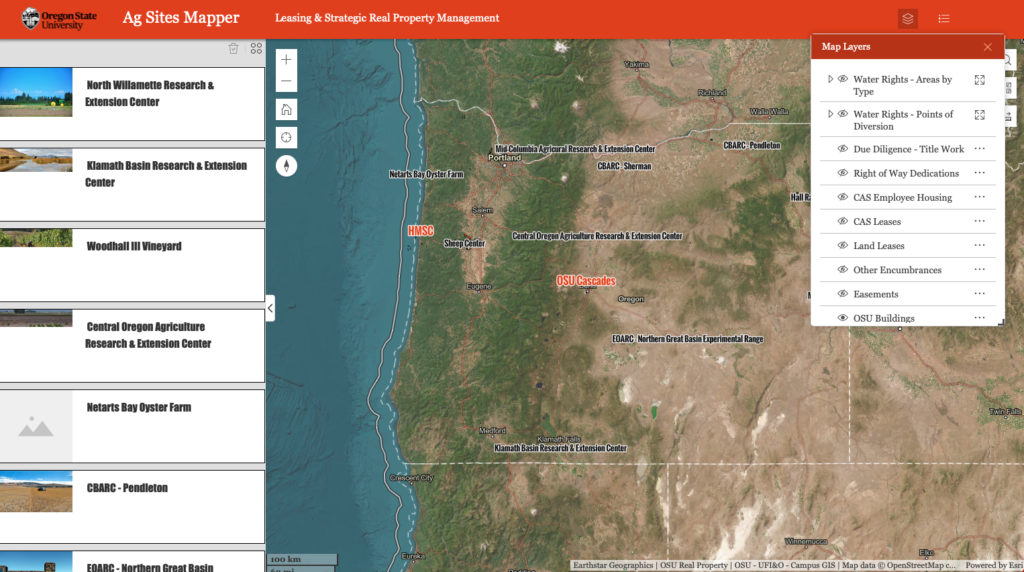
OSU’s College of Agricultural Sciences is the steward of the broadest physical portfolio of university land of any of OSU’s academic colleges, and their acreage is surpassed by only the College of Forestry’s Research Forests. CAS, unlike Forestry, does not have an internal GIS apparatus for site mapping and maintenance of locational datasets, so Real Property has partnered with CAS to develop the above app as a way to leverage data already present in the RP Map system in views specifically useful to college administrators, experiment station directors, and research farm personnel. The Ag Sites Mapper tool allows staff at the 14 farm and experimentation sites easy access to ownership, leasing, encumbrance, and other data with the ability to extend capabilities with external layers such as water rights and well locations from state agencies like the Oregon Water Rights Division, and long term goals of digitizing station-specific records such as septic locations and other station infrastructure.